Thanks to a grant from the Higher Education Coordinating Commission, OSU’s College of Earth, Ocean, and Atmospheric Sciences is partnering with Colorado State University to offer drone piloting and mapping classes to students and community members for free.
The hands-on trainings are spread across the state with options in Bend, Corvallis and Pendleton through late June. There are also online training opportunities so people can tune in from anywhere in Oregon. No prior experience is required; classes are capped at 18 people, and participants must be at least 18 to join.
Drone Flight School is a comprehensive five-day training seminar designed to teach all the material participants need to pass the Part 107 Remote Pilot licensing exam. It includes flight safety, FAA regulations, weather, airport operations and more, and participants will receive study and reference guides, policy examples and workflow templates.

The three-day UAV Mapping and Modeling course teaches participants how to capture aerial imagery using drones and then process that data into 3D models using the program Pix4D. Students will get to practice using several kinds of drones including Wingtra, Skydio and Parrot models, equipped with RGB and infrared cameras.
Colorado State University’s Drone Center has trained more than 1,700 pilots, and their team is providing both the equipment and the instructors. CEOAS has also partnered with Central Oregon Community College in Bend and Blue Mountain Community College in Pendleton to host the trainings in their regions and improve outreach to rural students.
“CEOAS likes to stay at the leading edge of research, so giving our students this leading-edge technology to accomplish their goals is definitely exciting,” said Kuuipo Walsh, director of the geographic information science (GIS) certificate program in CEOAS. “We’re proud to be able to provide this.”
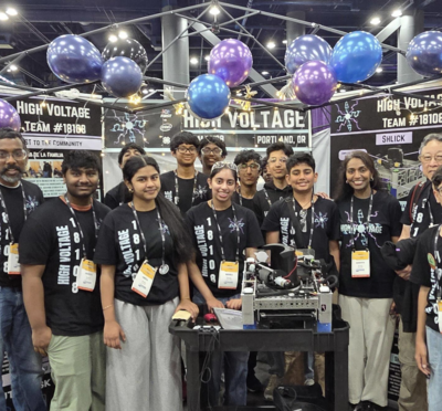
Student demand for drone classes has increased significantly in the past two years, specifically in the GIS program — one of the largest certificate programs at OSU, Walsh said — and in the online master’s degree in geography.
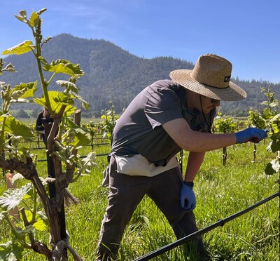
A large component of the GIS program is data collection out in the field, which can be done remotely via satellite but is increasingly done using drones, Walsh said. Researchers throughout CEOAS and other colleges use drones to collect data in inaccessible places, such as aerial photography of snow levels in mountain regions, gauging the impact of wildfires in forested areas or tracking whales at sea.
While online training is sufficient for the remote pilot exam and for participants to earn their pilot credentials, the in-person seminars are much more in-depth and effective, said Adam Smith, associate director of the CSU Drone Center.
“Many of the real-world mission-planning, flight-safety and operational details can only really be experienced firsthand,” he said. “It’s similar to watching a YouTube video to learn how to ride a bicycle: It might be helpful, but it doesn’t replace coasting down the hill when your parent finally lets go.”
The funding for these trainings comes at the tail end of a $1 million HECC Tech GIS workforce ready grant CEOAS received as part of $200 million allocated by a 2022 legislative investment focused on preparing Oregonians for careers in health care, manufacturing and technology. The majority of OSU’s grant focused on collaborating with industry partners to match students with internships, which has been in place for the past year and wraps up in June.
OSU graduate Adam Frus had only used a drone once prior to the training, but completed both the Drone Flight School and Mapping and Modeling classes earlier this month. He said the training directly aligns with his research and career goals, and he plans to use photogrammetry from drone operations to build models of natural structures when he begins his master’s degree in geospatial science in CEAOS this fall.
“I feel that becoming certified for commercial drone flights is a highly marketable skill for mapping, volume estimations and other scientific pursuits that I am interested in,” Frus said. “I think that this course offering was a really practical use of grant money that OSU had available.”
Through the same grant, Frus also completed an internship with the Oregon Department of Fish and Wildlife in summer 2025, which was an “incredible experience,” he said.
“I really hope that OSU continues to find grants like this to offer valuable, hands on learning to the students,” he said.
For more information and to register for training, visit the CSU Drone Center website.
Course schedule:
Corvallis
- Mapping and Modeling: April 13-15 and June 23-25.
- Drone Flight School: April 6-10 and June 15-19.
Bend
- Drone Flight School: April 27-May 1
- Mapping and Modeling: May 4-6
Pendleton
- Drone Flight School: May 18-22
- Mapping and Modeling: May 25-27
Remote
- April 27-June 30